Flagstaff Drone Photography & Aerial Video
High-resolution aerial photography and cinematic drone video created for Flagstaff real estate listings, commercial properties, vacation rentals, land, and construction projects.
Real Estate Aerial Photography
Cinematic Property Videos
Commercial Drone Photography
Land & Construction Progress
Professional Aerial Media That Helps Flagstaff Properties Stand Out
Reliable, Professional Drone Photography
We combine careful flight planning, professional editing, and local knowledge to create aerial images that highlight a property’s setting, scale, access, views, and surrounding Northern Arizona landscape.
High-Resolution Quality
Every project is photographed with attention to composition, lighting, property boundaries, and the features buyers want to see.
FAA-Compliant Service
Flights are planned around applicable FAA requirements, airspace restrictions, property access, and safe operating conditions.
Fast, Reliable Delivery
Most standard real estate projects are professionally edited and delivered within 24 to 48 hours after the flight.
Planning a Drone Photo Shoot?
Start Here.
Answers to common questions about scheduling, weather, delivery, service areas, and real estate drone photography in Flagstaff.
What is included with a real estate drone photography session?
How quickly will my photos and video be delivered?
Are your drone operations FAA compliant?
What areas around Flagstaff do you serve?
What happens if weather prevents the flight?
Showcase Every Property With Aerial Images Buyers Remember
Drone photography depends on safe wind, visibility, precipitation, and airspace conditions. When conditions are unsuitable, the session is rescheduled for the next practical date at no weather-related penalty.
Trusted by Flagstaff Property Professionals
The aerial photos made our listing feel larger, more connected to the surrounding forest, and much more impressive online. Delivery was fast and the images were ready to publish.
Flagstaff Real Estate Agent
The drone photography clearly documented the size, access, and surrounding development of our commercial property. The final files were polished and easy to use.
Commercial Property Owner
Professional communication, careful scheduling, and excellent results. The video gave prospective guests a true sense of the property and neighborhood.
Vacation Rental Host
The aerial views made it much easier for buyers to understand the parcel boundaries, road access, and surrounding terrain before visiting the land.
Land Listing Specialist
Our vacation rental finally shows its mountain setting and proximity to the trails. The new aerial images immediately improved the quality of the listing.
Northern Arizona Property Manager
Aerial Real Estate Media Built for Marketing Results
We combine FAA-certified flight operations, local Northern Arizona knowledge, professional DJI drone technology and AI-assisted post-production to create aerial photography and video that does more than look impressive. Every project is planned to communicate location, access, scale, views and property value clearly to prospective buyers, tenants, investors and guests.
FAA Part 107 Certified
Commercial flights are conducted by an FAA Part 107 certified remote pilot with attention to airspace, weather, property access and safe operating conditions.
Latest DJI Technology
Professional DJI drones and stabilized camera systems capture detailed aerial photographs and smooth cinematic video suitable for real estate marketing and digital campaigns.
AI-Enhanced Editing
Photos and videos are processed with modern AI-assisted tools for exposure balance, color accuracy, detail, stabilization, sharpening and a polished, natural final presentation.
Marketing-First Approach
Each shot is selected with the final listing, website, social post, advertising campaign and buyer experience in mind—not simply to create another collection of aerial images.
Drone Photography and Video for Every Type of Northern Arizona Property
Aerial media provides context that traditional ground-level photography cannot. It helps viewers understand where a property sits, how the land is arranged, what surrounds it and why the location is valuable. Services are available for residential and commercial marketing throughout Flagstaff and surrounding Northern Arizona communities.
Residential Real Estate
High-resolution aerial photos for single-family homes, mountain cabins, luxury estates, second homes and unique properties where scenery, lot size and neighborhood context influence buyer interest.
Cinematic Property Video
Professional aerial video sequences designed for listing pages, property websites, social media, broker presentations and branded marketing campaigns.
Commercial Real Estate
Aerial imagery for retail centers, offices, apartment communities, industrial sites, hospitality properties and investment real estate that needs clear visual context.
Land, Ranches and Acreage
Show access roads, terrain, neighboring development, vegetation, usable areas and the relationship between a parcel and its surrounding landscape.
Vacation Rentals and Resorts
Help guests visualize mountain settings, outdoor amenities, privacy, nearby attractions and the overall experience of staying at a Flagstaff or Northern Arizona property.
Construction Progress
Consistent aerial documentation for builders, developers, investors and property owners who need visual records of site preparation, construction phases and completed work.
Latest DJI Drones. AI-Assisted Processing. Human Quality Control.
Technology improves the workflow, but professional judgment determines the final result. Flights are planned around the property's strongest visual features, and every deliverable is reviewed before it is released.
- High-resolution aerial still photography
- Stabilized cinematic video capture
- AI-assisted exposure and color correction
- Detail enhancement and sharpening
- Video stabilization and scene selection
- Web, MLS and social-ready delivery
- Natural-looking final images
- Consistent professional quality review
What AI Enhancement Means
AI-assisted processing helps efficiently balance highlights and shadows, refine color, reduce noise, improve clarity and stabilize footage. It does not mean turning a property into something it is not. The goal is accurate, attractive media that presents the property professionally while maintaining a believable, natural appearance.
This workflow is especially useful in Northern Arizona, where bright skies, deep forest shadows, reflective snow, red rock terrain and rapidly changing light can all appear within the same project.
Media Created by a Digital Marketing Professional
Flagstaff Sky Shots is owned by Dan Decker, a graduate of Northern Arizona University and the owner of a web design and digital marketing company specializing in SEO, AEO and GEO. That background brings a marketing perspective to every photography and video project.
Rather than focusing only on operating a drone, the process considers how images will be used across MLS listings, property websites, Google Business Profiles, social media, online advertising and local search. The result is a stronger collection of visual assets that supports the entire property marketing campaign.
Visual Assets That Support Search, Answers and Local Discovery
Search engines and AI answer platforms rely on clear entities, locations, services and supporting media. Professional aerial assets can strengthen property pages, community pages, neighborhood content, local landing pages and marketing campaigns when they are used with descriptive filenames, relevant alternative text and accurate location context.
- Real estate listing and property website media
- Google Business Profile content
- Community and neighborhood landing pages
- Social and short-form video campaigns
- Agent and brokerage listing presentations
- Commercial development marketing
What Drone Photography Shows That Ground Photography Cannot
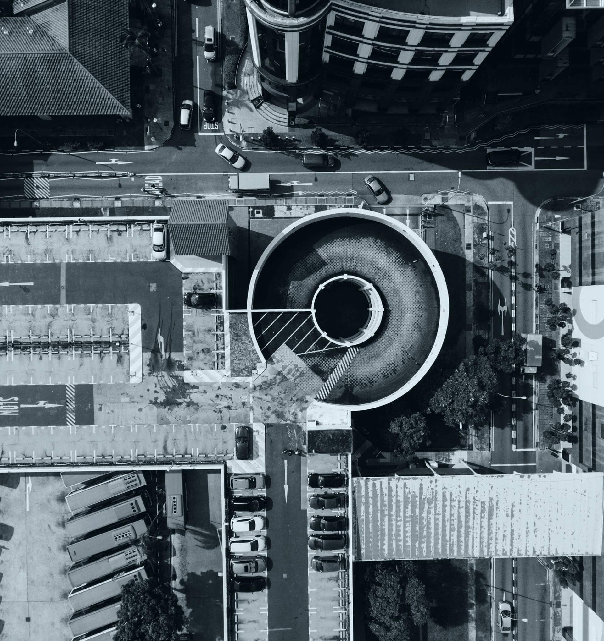
Ground-level images remain important, but they rarely explain the full property. Aerial photography fills that gap by presenting the building, lot, road access, outdoor improvements and surrounding area in a single visual story.
Location and Surroundings
Show proximity to forests, trails, golf courses, downtown districts, highways, mountain views, open space and nearby amenities without requiring the viewer to interpret a map alone.
Scale and Property Layout
Help viewers understand lot size, building placement, driveways, detached structures, landscaping, parking, access points and the relationship between multiple improvements.
A Stronger First Impression
A compelling aerial lead image or opening video sequence can stop the scroll and encourage buyers, tenants or guests to spend more time exploring the complete listing.
Local Drone Photography Across Northern Arizona
Based in the Flagstaff market, we serve real estate agents, property owners, builders, developers and businesses throughout Northern Arizona. Flight availability depends on airspace, weather, site conditions and project requirements.
Some locations may require additional travel time, flight authorization or scheduling flexibility.
Frequently Asked Questions
Clear answers for real estate agents, brokers, property owners, developers and vacation rental hosts planning an aerial photography or video project.
Are you an FAA-certified drone pilot?
What is included in a real estate drone photography session?
Do you provide cinematic drone video?
How quickly are photos and videos delivered?
Do you use professional DJI drones?
How are the images edited?
Can you photograph land, ranches and large parcels?
Can drones fly everywhere in Flagstaff?
What happens when the weather is poor?
Do you work with commercial properties and construction sites?
What should be prepared before the drone arrives?
Which Northern Arizona communities do you serve?
Request Flagstaff Drone Photography and Video
Real Estate Drone Photography Resources
Helpful guidance for real estate agents, property owners, builders, and vacation rental managers using aerial photography to market properties throughout Flagstaff and Northern Arizona.
Discover practical ways to prepare a property, choose the best flight time, and get more value from professional drone photos and video.